Press Contact

Jessica Brewer
jbrewer@zondahome.com

Company News

Track construction sites with Bird.i

Apr 06, 2020

On April 6th, we announced the acquisition of satellite imagery service, Bird.i, giving customers real-time access to satellite and airborne imagery, all in one platform.

Powering Access to Satellite Imagery and Data

Bird.i’s proprietary satellite imagery and artificial intelligence (AI) technology capture real-time images of ongoing projects allowing for more timely, better-informed decision making throughout the building process. 
 
Data is collected from the top imagery providers to create instantaneous updates and a robust experience, all in one platform. 
 
 
Providers include:

“The Bird.i satellite imagery is an incredible opportunity to assess and monitor development from land to housing in a new format." 

EVP, Product Development, Lorry Lynn

791284b9-2ef5-4ffa-9aa9-7575f5793219

Imagery and Intelligence to Elevate Your Business

With real-time updates on land and construction activities, we provide insights for housing professionals to make strategic decisions to lead, grow, and expand their businesses.
 
Key features include:
  • Up-to-date satellite imagery to find and assess land for development with an accurate representation of location, land use, scale and proximity to key access points in their current state.
  • Track the progress of construction sites over time with multiple snapshots before, during and after the project; a perfect addition for internal reports or to share individually or with remote members for a quick visual update.
  • Ability to monitor multiple sites within minutes to easily track your own projects and competitors’ projects around you. 
 

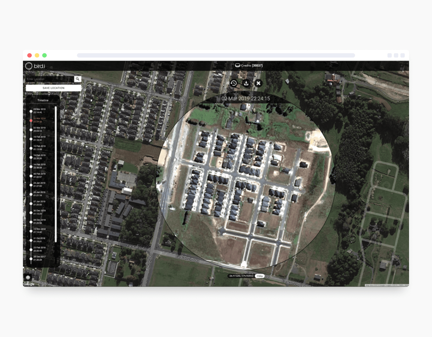
With these features, construction activity can be identified and monitored to develop your strategy and give a competitive edge. 

Recent news