Self-Guided Tours: Empowering Homebuilder Sales Teams, Not Replacing Them


Historically, monitoring real estate development projects involved sending analysts to visit construction sites in person or relying on free applications like Google Maps.
The first option offers valuable first-hand insights but isn’t scalable and quickly becomes resource-intensive. And with the onset of COVID-19, it became unsafe—or even impossible—to travel at all.
Although satellite imagery is available in numerous online mapping portals, users have no control over image currency or quality, often leaving analysts with outdated information that misrepresents the reality of what is happening on the ground.
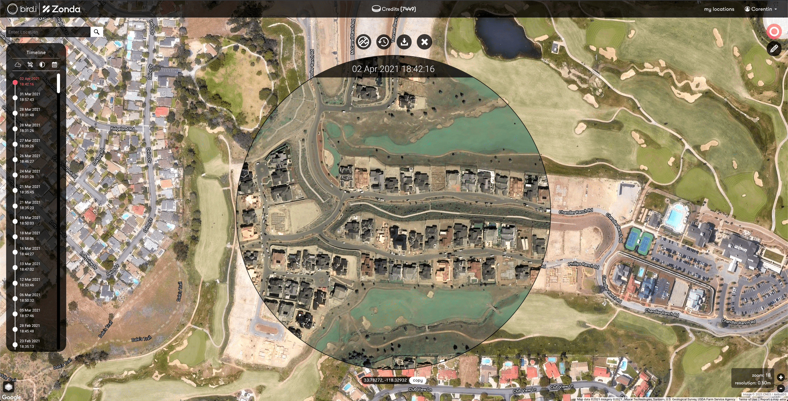
To keep staff safe and continue supplying accurate real estate information, Zonda recently acquired Bird.i, a construction activity analytics company, and partnered with the two world-leading satellite operators Airbus and Maxar to access up-to-date high-resolution imagery.
Zonda’s research platform, called Integrated Research Intelligence System (IRIS), streams very high-resolution satellite imagery via API to monitor more than 60,000 housing projects in the United States. The platform provides up-to-date insights to Zonda’s customers, which include builders, building product manufacturers, mortgage lenders, and multifamily development executives.

Leveraging artificial intelligence (AI) to move from the past to a post-pandemic future
Before COVID-19, updating nationwide real estate development projects throughout various stages of construction relied upon large groups of people, called survey teams. A survey team would sift through permits, deeds, tax records, and sales and traffic data, perform site visits, and gather other types of related information on a quarterly basis. The team manually input all of that data into Zonda’s central database.
Beginning in March 2020, travel restrictions and concerns for safety prevented survey teams from performing most of their usual site visits to active construction projects. The teams needed current, highly detailed visuals of what was happening on the ground at development sites across the United States.

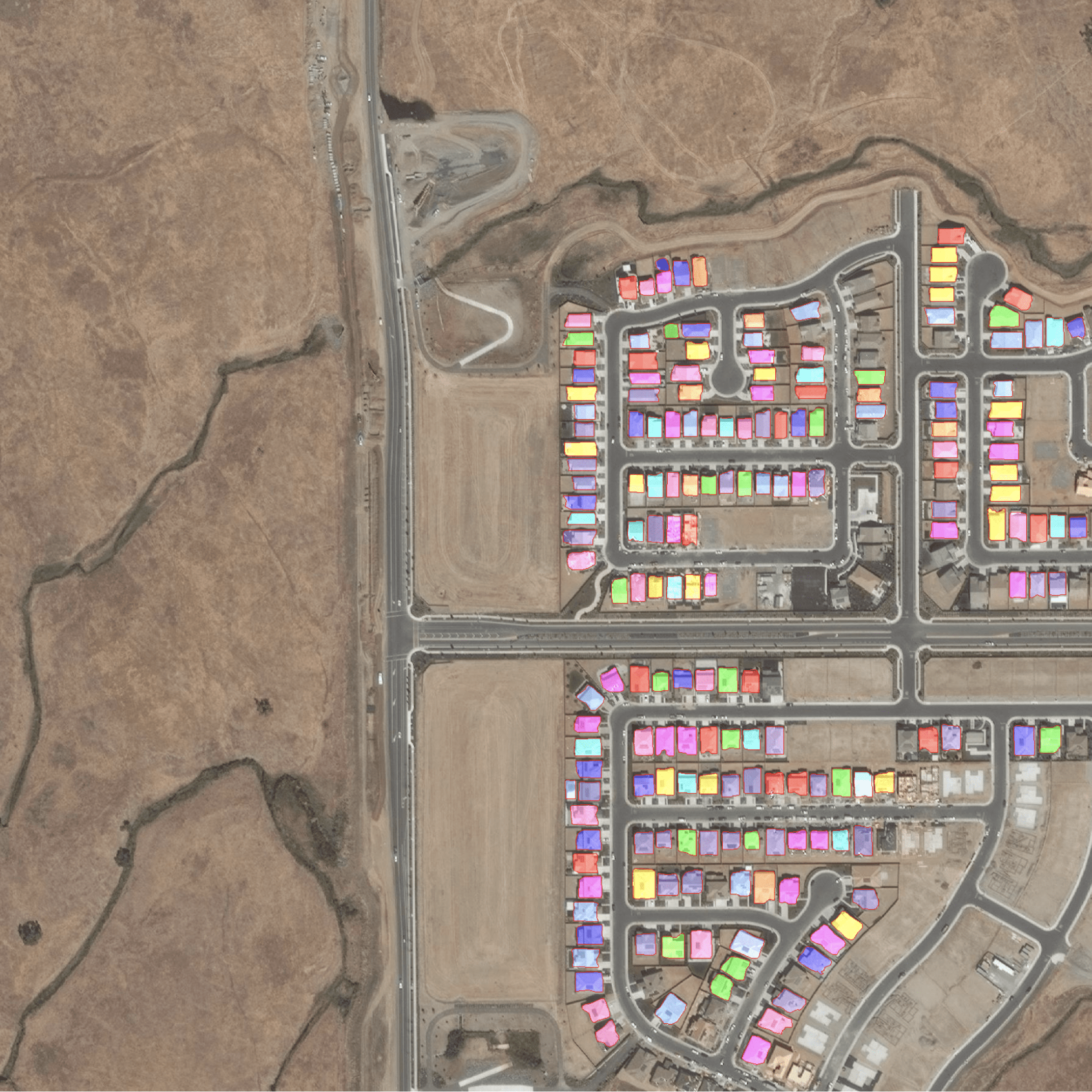
When it became apparent that the travel impacts of COVID-19 were going to be lasting, Zonda bolstered its robust data analytics platform with Bird.i. New machine learning (ML) models were built and deployed so that specific phases of construction could be detected faster and reported more accurately at a scale much larger than a survey team could cover by traveling in person.

Today, Zonda’s platform works by constantly ingesting all-new satellite images acquired over a given area. In many cases, new images are available within the satellite operators’ services as quickly as an hour after they are collected by a satellite. As soon as a new image is available, the small section corresponding to the geometry is retrieved and processed with ML to identify residential properties and their construction stages. The ML models’ outputs are delivered automatically to the research platform, which updates millions of records daily.
Combining AI with on-demand access to fresh high-resolution satellite imagery has drastically increased the efficiency of construction project monitoring across the United States. Automated integration with Airbus and Maxar’s solutions enables Zonda to monitor development on the ground around the world from a computer and accurately relay project stages to customers. Despite a 40% drop in site visits during the pandemic, Zonda was able to monitor construction sites nationwide and release its second-, third- and fourth-quarter 2020 reports on time.